ItenasItenasItenas Itenas
  • ITENAS
    • ABOUT ITENAS
    • DAYANG SUMBI EDUCATION FOUNDATION
    • ITENAS EXECUTIVE BOARD
    • ITENAS VIRTUAL TOUR
    • CONTACT
  • ACADEMIC
    • FACULTY OF INDUSTRIAL TECHNOLOGY
      • ELECTRICAL ENGINEERING
      • MECHANICAL ENGINEERING
      • MECHANICAL ENGINEERING (MASTER PROGRAM)
      • INDUSTRIAL ENGINEERING
      • INDUSTRIAL ENGINEERING (MASTER PROGRAM)
      • CHEMICAL ENGINEERING
      • INFORMATICS
      • INFORMATION SYSTEM
    • FACULTY OF CIVIL ENGINEERING AND PLANNING
      • CIVIL ENGINEERING
      • CIVIL ENGINEERING (MASTER PROGRAM)
      • GEODETIC ENGINEERING
      • URBAN AND REGIONAL PLANNING
      • ENVIRONMENTAL ENGINEERING
    • FACULTY OF ARCHITECTURE AND DESIGN
      • ARCHITECTURE
      • INTERIOR DESIGN
      • PRODUCT DESIGN
      • VISUAL COMMUNICATION DESIGN
  • STUDENT
    • EXAM SCHEDULE
    • ACADEMIC CALENDAR
    • TUITION PAYMENT
    • CAMPUS LIFE
    • STUDENT AFFAIRS
    • STUDENT ACADEMIC
  • ACHIEVEMENT
    • PERFORMANCE
  • OTHERS
    • SURVEY INVITATION
    • ECO-FRIENDLY CAMPUS
    • E-LEARNING
    • COLLABORATION
    • RESEARCH
    • COMMUNITY SERVICE
    • SCIENCE TECHNO PARK
    • COMPETITIONS
    • DOWNLOAD
      • FILE DOWNLOAD
      • ITENAS BROCHURE
      • STUDY PROGRAM BROCHURE
      • ITENAS LOGO
      • 50 YEARS OF ITENAS TEMPLATE
      • ZOOM BACKROUND ITENAS
  • SCHOLARSHIP

REGISTRATION  

  • ITENAS
    • ABOUT ITENAS
    • DAYANG SUMBI EDUCATION FOUNDATION
    • ITENAS EXECUTIVE BOARD
    • ITENAS VIRTUAL TOUR
    • CONTACT
  • ACADEMIC
    • FACULTY OF INDUSTRIAL TECHNOLOGY
      • ELECTRICAL ENGINEERING
      • MECHANICAL ENGINEERING
      • MECHANICAL ENGINEERING (MASTER PROGRAM)
      • INDUSTRIAL ENGINEERING
      • INDUSTRIAL ENGINEERING (MASTER PROGRAM)
      • CHEMICAL ENGINEERING
      • INFORMATICS
      • INFORMATION SYSTEM
    • FACULTY OF CIVIL ENGINEERING AND PLANNING
      • CIVIL ENGINEERING
      • CIVIL ENGINEERING (MASTER PROGRAM)
      • GEODETIC ENGINEERING
      • URBAN AND REGIONAL PLANNING
      • ENVIRONMENTAL ENGINEERING
    • FACULTY OF ARCHITECTURE AND DESIGN
      • ARCHITECTURE
      • INTERIOR DESIGN
      • PRODUCT DESIGN
      • VISUAL COMMUNICATION DESIGN
  • STUDENT
    • EXAM SCHEDULE
    • ACADEMIC CALENDAR
    • TUITION PAYMENT
    • CAMPUS LIFE
    • STUDENT AFFAIRS
    • STUDENT ACADEMIC
  • ACHIEVEMENT
    • PERFORMANCE
  • OTHERS
    • SURVEY INVITATION
    • ECO-FRIENDLY CAMPUS
    • E-LEARNING
    • COLLABORATION
    • RESEARCH
    • COMMUNITY SERVICE
    • SCIENCE TECHNO PARK
    • COMPETITIONS
    • DOWNLOAD
      • FILE DOWNLOAD
      • ITENAS BROCHURE
      • STUDY PROGRAM BROCHURE
      • ITENAS LOGO
      • 50 YEARS OF ITENAS TEMPLATE
      • ZOOM BACKROUND ITENAS
  • SCHOLARSHIP

Itenas and the Geospatial Information Agency (BIG) Sign the MoU on the Utilization and Use of Geospatial Information

By Bhakti Herdianto News,
22Jun, 2022

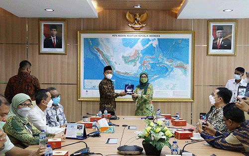
On Wednesday, 22nd June 2022, a Memorandum of Agreement was signed between BIG and Institut Teknologi Nasional (Itenas). The event was held in the Main Meeting Room of Building A Lv.2, BIG Office, Jl. Raya Jakarta-Bogor KM.46, Cibinong, Bogor, West Java.


The MoU, which was created based on the Tri Darma of Higher Education based on the utilization and use of geospatial information, was signed by the Rector of Itenas, Prof. Meilinda Nurbanasari, Ph.D., and Head of BIG, Prof.Dr.rer.nat. Muh Aris Marfai. 


On her speech, Prof. Meilinda was hoping that this collaboration can support Merdeka Belajar Kampus Merdeka (MBKM) program which is running in Itenas. “One of the implementations of MBKM program is a one-semester internship system for students in related industries”.


With the growth of science and technology in geodetic science, the need for geodesy graduates is very high. This high demand is the challenge that we hope can be fulfilled by Itenas so that it can be absorbed by stakeholders in the future.


The scope of the MoU includes the implementation of geospatial information; study and implementation of science and technology in the field of geospatial information; improvement and development of human resource competencies related to geospatial information; information dissemination about geospatial information to support community service activities; and other approved activities in the future.


On the implementation of Geospatial Information (IG), BIG has many supporting data that can be used by universities like Itenas. Moreover, BIG has a lot of tide stations and Continuously Operating Reference Stations (CORS) whose amount is increasing. “This data is amazing and can be used by students for research. This data is also free,” said Prof. Dr. rer. Nat. Muh Aris. The head of BIG hoped that this collaboration can realize the utilization and development of science and technology related to Geospatial Information (IG) to support national development and improve the quality of the implementation of tasks and functions of BIG and Itenas.

Tags:BIG Informasi Geospasial (IG) Institut Teknologi Nasional Merdeka Belajar Kampus Merdeka (MBKM) Prof. Meilinda Nurbanasar

Previous

Bring 3 Leadership Experts, A Forum for Itenas Leaders and Academicians: Transformational Leadership in Digital Era Was Held Offline in Itenas
June 20, 2022

Next

Gold Winner Achievement in Itenas’ Golden Age from the Anugerah Diktiristek 2022
January 6, 2023

Berita

  • Itenas Held Send-off Event of Its Four IISMA 2023 Awardees to World Best Universities
  • Itenas and SMAN 19 Bandung Signed the MoU for the Academic and New Student Admission Partnership
  • Introduction to “Huawei ICT Academy Program” to Itenas’ Students for Creating Skillful Graduates in ICT Industries
X